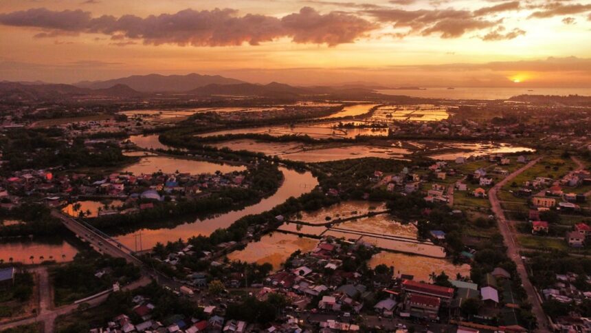
Urban flood risk represents a critical challenge for cities worldwide, driven by accelerating urbanization and climate change that increase both the frequency and severity of flood events. The interaction between natural hydrological processes and urban development creates distinct vulnerabilities in metropolitan areas. Impermeable surfaces including concrete, asphalt, and building structures prevent natural water infiltration into soil, generating elevated surface runoff volumes that exceed the capacity of existing drainage infrastructure and produce widespread flooding.
Comprehensive assessment of urban flood risk requires analysis of both physical urban characteristics and socio-economic variables that determine community vulnerability. Physical factors include topography, drainage network capacity, land use patterns, and the extent of impervious surface coverage. Socio-economic determinants encompass population demographics, economic resources, and institutional capacity for flood management.
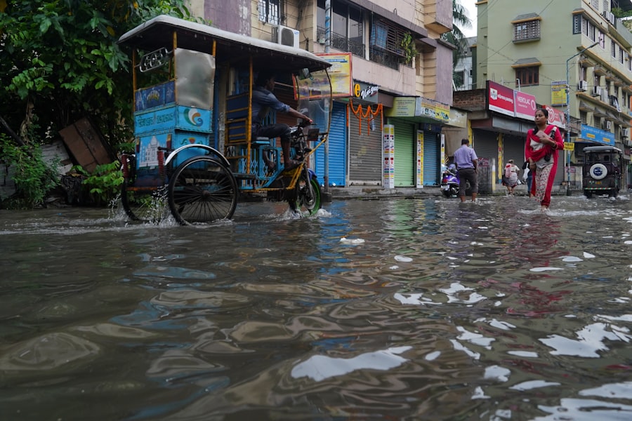
Population density, infrastructure condition, and economic status substantially influence flood exposure and impact severity. Lower-income communities frequently experience disproportionate flood risks due to inadequate drainage systems, substandard housing construction, limited emergency resources, and location in flood-prone areas such as floodplains or low-lying zones.
These disparities can result in severe economic losses, property damage, and public health consequences for affected residents. Effective urban flood risk management requires evidence-based understanding of these spatial and social variations. This knowledge enables urban planners, engineers, and policymakers to design targeted flood mitigation strategies, prioritize infrastructure investments, and implement protective measures that address the specific needs of vulnerable populations and high-risk areas.
Key Takeaways
- Urban flood risk mapping is essential for identifying vulnerable areas and managing flood hazards effectively.
- Advanced data and technology, including GIS and remote sensing, enhance the accuracy of flood risk assessments.
- Community involvement and government collaboration are critical for successful flood risk management and planning.
- Integrating climate change projections into flood risk mapping helps prepare cities for future flood scenarios.
- Economic and social impacts of urban flooding highlight the need for proactive strategies and continuous improvement in flood risk mapping.
Importance of Flood Risk Mapping
Flood risk mapping serves as a critical tool in understanding and managing urban flood risks. These maps provide visual representations of areas prone to flooding, allowing stakeholders to identify high-risk zones and prioritize resources effectively. By illustrating the potential extent of flooding during various scenarios, flood risk maps enable cities to prepare for and respond to flooding events more efficiently.
They also serve as essential tools for informing the public about potential hazards, fostering a culture of preparedness within communities. In addition to enhancing preparedness, flood risk mapping plays a vital role in urban planning and development. By integrating flood risk data into land-use planning, cities can make informed decisions about where to build infrastructure and housing.
This proactive approach helps to minimize future flood damage and ensures that new developments are resilient to potential flooding events. Ultimately, effective flood risk mapping is essential for creating safer, more sustainable urban environments.
Data and Technology for Flood Risk Mapping
The advancement of data collection and technology has revolutionized the field of flood risk mapping. Geographic Information Systems (GIS) have become indispensable tools for urban planners and researchers, allowing them to analyze spatial data and visualize flood risks in intricate detail. By combining various data sources—such as topography, land use, and historical flood records—GIS enables the creation of comprehensive flood risk maps that can inform decision-making processes.
In addition to GIS, remote sensing technologies have significantly enhanced the ability to monitor and predict flooding events. Satellite imagery and aerial surveys provide real-time data on rainfall patterns, river levels, and land surface changes, allowing for timely assessments of flood risks. Furthermore, advancements in machine learning and predictive modeling have improved the accuracy of flood forecasts, enabling cities to implement early warning systems that can save lives and reduce property damage.
Identifying Vulnerable Areas in Cities
Identifying vulnerable areas within urban environments is crucial for effective flood risk management. Vulnerability assessments consider various factors, including socio-economic conditions, infrastructure resilience, and environmental characteristics. By analyzing these elements, city planners can pinpoint neighborhoods that are at higher risk of flooding and prioritize interventions accordingly.
For instance, areas with a high concentration of low-income households may lack the resources necessary to recover from flooding events. Additionally, neighborhoods with aging infrastructure may be more susceptible to flooding due to inadequate drainage systems. By focusing on these vulnerable areas, cities can allocate resources more effectively and implement targeted strategies that address the specific needs of at-risk communities.
Implementing Flood Risk Management Strategies
| Metric | Description | Typical Value/Range | Unit | Relevance to Flood Risk Mapping |
|---|---|---|---|---|
| Elevation | Height above sea level or river level | 0 – 500 | meters | Determines flood susceptibility based on terrain height |
| Land Use Type | Classification of urban land (residential, commercial, green space) | N/A | Category | Influences runoff and water absorption capacity |
| Impervious Surface Percentage | Proportion of surfaces that prevent water infiltration | 10 – 90 | Percent (%) | Higher values increase surface runoff and flood risk |
| Drainage Density | Length of drainage channels per unit area | 0.5 – 5 | km/km² | Indicates efficiency of water drainage in urban areas |
| Rainfall Intensity | Amount of rainfall over a short period | 10 – 200 | mm/hr | High intensity can overwhelm drainage and cause flooding |
| Soil Permeability | Rate at which soil absorbs water | Low, Medium, High | Category | Affects infiltration and surface runoff |
| Flood Return Period | Average interval between floods of a certain magnitude | 5 – 100 | Years | Used to estimate flood risk frequency |
| Population Density | Number of people per unit area | 1000 – 20000 | people/km² | Higher density increases potential flood impact |
| Historical Flood Extent | Area previously affected by flooding | N/A | km² | Helps validate flood risk models and maps |
Implementing effective flood risk management strategies requires a multifaceted approach that combines engineering solutions with community engagement and policy initiatives. Structural measures such as levees, floodwalls, and retention basins can help mitigate the impacts of flooding by controlling water flow and reducing runoff. However, these solutions must be complemented by non-structural measures such as land-use planning, zoning regulations, and public education campaigns.
Moreover, fostering collaboration among various stakeholders—including government agencies, community organizations, and residents—is essential for successful flood risk management. Engaging communities in the planning process not only enhances the effectiveness of strategies but also empowers residents to take an active role in protecting their neighborhoods from flooding. By creating a sense of ownership and responsibility, cities can build resilience against future flooding events.
Community Engagement in Flood Risk Mapping
Community engagement is a vital component of effective flood risk mapping. Involving residents in the mapping process ensures that local knowledge and experiences are incorporated into flood risk assessments. This participatory approach not only enhances the accuracy of flood risk maps but also fosters trust between communities and decision-makers.
Workshops, public meetings, and online platforms can facilitate community input in identifying vulnerable areas and prioritizing interventions. By encouraging residents to share their experiences with flooding—such as historical events or near-misses—planners can gain valuable insights into local conditions that may not be captured through traditional data sources. Ultimately, community engagement strengthens the overall resilience of urban areas by fostering a collaborative approach to flood risk management.
Role of Government and Urban Planning in Flood Risk Mapping
Government agencies play a crucial role in flood risk mapping by providing the necessary resources, expertise, and regulatory frameworks to support effective planning and management. Local governments are often responsible for developing flood risk maps that inform land-use planning decisions and guide infrastructure investments. By integrating flood risk data into urban planning processes, governments can ensure that new developments are designed with resilience in mind.
Additionally, collaboration between different levels of government—federal, state, and local—is essential for comprehensive flood risk management. Federal agencies can provide funding and technical assistance to support local efforts in mapping and managing flood risks. Furthermore, establishing clear policies and regulations regarding land use in flood-prone areas can help mitigate future risks and protect communities from the impacts of flooding.
Integrating Climate Change into Flood Risk Mapping
As climate change continues to alter weather patterns and increase the frequency of extreme weather events, integrating climate projections into flood risk mapping has become increasingly important. Traditional flood risk assessments often rely on historical data; however, this approach may not accurately reflect future conditions under climate change scenarios. By incorporating climate models into flood risk mapping efforts, cities can better anticipate potential changes in rainfall patterns, sea-level rise, and other factors that contribute to flooding.
This integration allows for more robust planning and decision-making processes that account for future uncertainties. For instance, cities can identify areas that may become more vulnerable due to climate change and prioritize adaptation measures accordingly. By proactively addressing these challenges, urban planners can enhance the resilience of communities against the impacts of climate change-induced flooding.
Economic and Social Impacts of Urban Flooding
The economic and social impacts of urban flooding are profound and far-reaching. Flooding can lead to significant property damage, disrupt local economies, and displace residents from their homes. The costs associated with recovery efforts—such as repairs to infrastructure, emergency response services, and financial assistance for affected individuals—can strain municipal budgets and divert resources from other critical services.
Socially, flooding disproportionately affects marginalized communities that may lack the resources to recover quickly or effectively. The psychological toll of experiencing a flood event can also have lasting effects on individuals and families. Understanding these economic and social impacts is essential for developing comprehensive flood risk management strategies that prioritize equity and resilience.
Case Studies of Successful Flood Risk Mapping
Examining case studies of successful flood risk mapping initiatives provides valuable insights into best practices and lessons learned. For example, New York City has implemented a comprehensive approach to flood risk mapping that incorporates community input, advanced technology, and climate projections. The city’s Flood Hazard Maps serve as essential tools for guiding land-use planning decisions while engaging residents in discussions about resilience strategies.
Similarly, Rotterdam has developed an innovative approach to managing urban water through its “Room for the River” program. This initiative focuses on creating multifunctional spaces that accommodate water while enhancing urban livability. By integrating flood risk mapping into their planning processes, both cities have demonstrated how proactive measures can lead to more resilient urban environments.
Future Challenges and Opportunities in Urban Flood Risk Mapping
As cities continue to grow and face evolving challenges related to climate change, the future of urban flood risk mapping will require ongoing innovation and adaptation. One significant challenge lies in ensuring that data collection methods remain up-to-date and relevant in an ever-changing environment. As new technologies emerge, cities must be willing to invest in research and development to enhance their mapping capabilities.
Conversely, these challenges also present opportunities for collaboration among stakeholders at all levels—government agencies, private sector partners, academic institutions, and community organizations. By working together to share knowledge, resources, and expertise, cities can develop more effective flood risk mapping strategies that promote resilience and sustainability. Embracing these opportunities will be crucial for navigating the complexities of urban flood risks in the years ahead.
Flood risk mapping in urban areas is crucial for effective disaster management and urban planning. A related article that delves into the methodologies and technologies used in flood risk assessment can be found at com/sample-page/’>this link.
This resource provides valuable insights into how cities can better prepare for and mitigate the impacts of flooding, ensuring the safety and resilience of their communities.
FAQs
What is flood risk mapping in urban areas?
Flood risk mapping in urban areas involves identifying and visualizing regions within cities that are susceptible to flooding. It uses data on topography, rainfall, drainage systems, and historical flood events to assess the likelihood and potential impact of floods.
Why is flood risk mapping important for urban areas?
Flood risk mapping helps city planners, emergency responders, and residents understand which areas are vulnerable to flooding. This information is crucial for disaster preparedness, infrastructure development, zoning regulations, and minimizing damage to property and loss of life.
What data sources are used for flood risk mapping?
Common data sources include satellite imagery, digital elevation models (DEMs), rainfall records, river flow data, land use maps, soil types, and historical flood records. Advanced models may also incorporate climate change projections and urban drainage system details.
How is flood risk assessed in urban flood mapping?
Flood risk is typically assessed by combining the probability of flood occurrence with the potential consequences. This involves hydrological and hydraulic modeling to simulate flood scenarios, considering factors like rainfall intensity, surface runoff, and drainage capacity.
What technologies are used in urban flood risk mapping?
Technologies include Geographic Information Systems (GIS), remote sensing, hydrodynamic modeling software, and sometimes drones for data collection. These tools help analyze spatial data and create detailed flood risk maps.
Can flood risk maps predict future flooding events?
Flood risk maps do not predict specific future events but provide probabilistic assessments based on historical data and modeling. They indicate areas at risk under various scenarios, helping to prepare for potential floods.
How often should flood risk maps be updated?
Flood risk maps should be updated regularly, especially after significant urban development, changes in land use, or major flood events. Updates ensure that maps reflect current conditions and provide accurate risk assessments.
Who uses flood risk maps in urban areas?
Users include urban planners, government agencies, emergency management teams, insurance companies, developers, and the general public. Each group uses the maps for planning, risk mitigation, response strategies, and informed decision-making.
What are the limitations of flood risk mapping in urban areas?
Limitations include data accuracy, resolution constraints, changing climate patterns, and the complexity of urban drainage systems. Additionally, unexpected events or infrastructure failures can lead to flooding outside predicted risk zones.
How can communities benefit from flood risk mapping?
Communities can use flood risk maps to improve preparedness, advocate for better infrastructure, make informed property decisions, and participate in risk reduction initiatives. Awareness of flood risks can lead to safer, more resilient urban environments.